Exploring the NDVI Index Post 2022 Mosquito Fire
Background:
Wildfires are an increasing threat to ecosystems, infrastructure, and public health, especially in drought-prone areas like California. The Mosquito Fire, which burned over 75,000 acres from September 6 to October 22, 2022, severely impacted the Tahoe and El Dorado National Forests. These fires not only destroy vegetation but also alter landscapes, disrupt transportation, and impact water resources. Understanding post-fire vegetation loss is crucial for ecological recovery efforts and future wildfire mitigation strategies. This project aims to quantify vegetation change using the Normalized Difference Vegetation Index (NDVI), comparing pre- and post-fire vegetation density in the affected areas.
Geographic Data Being Used:
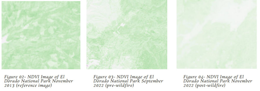
The analysis relies on satellite imagery from the USGS LandsatLook website, which provides multi-spectral remote sensing data. We acquired NDVI data from two time periods—before and after the Mosquito Fire (August 2022 and October 2022)—to assess the extent of vegetation loss. The NDVI measures vegetation health by comparing infrared and visible light reflectance, with values ranging from -1 to 1 (higher values indicate healthier vegetation). To provide a historical baseline, we also incorporated a reference image from November 2013 to compare long-term vegetation trends.
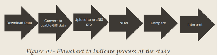
Geographic Methods/Models Applied to Data:
To process and analyze the geographic data, we used ArcGIS Pro with the following steps:
-
Data Collection & Preprocessing: Downloaded Landsat images (pre- and post-fire) and converted JSON files into polygon shapefiles.
-
Infrared Image Conversion: Applied Near-Infrared (NIR) band combinations to emphasize vegetation differences.
-
NDVI Calculation: Computed NDVI values for both time periods using the NDVI formula: NDVI = (NIR - Red) / (NIR + Red) where NIR represents near-infrared reflectance and Red represents visible red reflectance.
-
Comparison & Visualization: Generated NDVI maps to visualize vegetation density changes and quantify reductions.
What was Found
The NDVI analysis confirmed a significant decrease in vegetation density following the Mosquito Fire. Pre-fire NDVI values in the study area were close to 1, indicating healthy, dense vegetation. Post-fire NDVI values dropped closer to 0, reflecting widespread vegetation loss. The comparison maps illustrate that areas with previously dense forests experienced severe reduction in vegetation cover, with some transitioning to bare soil. The reference image from 2013 also showed a higher NDVI value, suggesting that long-term wildfire activity may be contributing to persistent vegetation decline in the region.
Project 1
Project 1

Explanation of Results as Conclusions
The findings align with expectations that large-scale wildfires drastically reduce vegetation density. The drop in NDVI values confirms that the Mosquito Fire significantly impacted plant life, disrupting local ecosystems. Factors such as drought conditions, high fuel loads, and climate change have likely intensified wildfire severity, making recovery more challenging. The results emphasize the importance of post-fire land management, including reforestation efforts and fire mitigation strategies, to restore ecological balance in wildfire-prone areas. By leveraging GIS and NDVI analysis, researchers and policymakers can better assess wildfire damage and develop data-driven restoration plans.
Refrences
Landsatlook. (n.d.). “California, Aug. 2022,” “California, Oct, 2022” Retrieved April 10, 2023, from https://landsatlook.usgs.gov/explore?date=2022-10- 25%7C2022-10- 26&sat=LANDSAT_9 (2017).
Supervised Image Classification in ArcGIS Desktop - ArcMap. Retrieved April 10, 2023, from https://youtu.be/HC2QbrIvc2g